Best Hiking in Vail: A Local's Guide to Summer Trails
Jul 31st 2026
Winter may have put Vail on the map, but summer is when many locals fall in love with it all over again.
As the snow melts, miles of hiking trails wind through aspen groves, wildflower-filled meadows, waterfalls, alpine lakes, and panoramic mountain views. Whether you're looking for a leisurely walk or a challenging summit, there's a trail for every kind of adventurer.
Here are some of our favorite hikes in and around Vail, along with a few local tips to help you make the most of your day on the trail.
Booth Falls Trail
If you're only doing one hike in Vail, make it Booth Falls.
This iconic trail climbs through pine forest and aspen groves before reaching a dramatic 60-foot waterfall cascading over granite cliffs. During July and early August, wildflowers line much of the trail, and the views continue to improve as you gain elevation.
Many hikers stop at the falls, but if you're looking for a bigger adventure, continue another two miles to Booth Lake. The alpine lake sits beneath rugged peaks and is one of our favorite places to enjoy a quiet lunch before hiking back down.
Know Before You Go
- Distance to Booth Falls: about 4 miles round trip
- Distance to Booth Lake: additional 2.5 miles
- Difficulty: Moderate to strenuous
- Best time: Early morning
- Interactive trail map on CORTEX
Parking at the trailhead is extremely limited and fills quickly. Save yourself the frustration and take the free Town of Vail bus to the Booth Falls stop. It's easier, less stressful, and better for everyone.
North Trail
If Booth Falls is Vail's celebrity hike, North Trail is the local favorite.
Running above Vail through shaded forests and open meadows, North Trail offers incredible mountain scenery without the constant crowds. You can hike short sections for an easy morning walk or connect with longer routes like Son of Middle Creek or Buffehr Creek for a bigger adventure.
The trail is especially beautiful early in the morning when sunlight filters through the aspens and wildlife is still active.
It's also one of the best places to experience Vail's spectacular fall colors if you visit in September.
Know Before You Go
- Difficulty: Moderate
- Distance: Flexible. Hike a short out-and-back or connect with other trails for a longer adventure.
- Best Time: Morning or early evening when wildlife is most active.
- Shade: One of Vail's better trails for escaping the afternoon sun.
- Local Tip: This is where many locals hike when Booth Falls is packed.
- Interactive trail map in CORTEX
Bighorn Trail
For hikers looking for more elevation and panoramic views, Bighorn Trail is a fantastic option.
This trail climbs steadily through forest before opening to sweeping vistas of Vail Mountain and the Gore Range. It also connects with North Trail, allowing you to customize longer loop hikes depending on your energy level.
It's less traveled than Booth Falls, making it a great choice if you're looking for a little more solitude.
Know Before You Go
- Difficulty: Moderate
- Distance: Approximately 5 to 8 miles, depending on your route.
- Best Time: Summer mornings and early fall.
- Trail Connections: Easily combined with North Trail for a longer loop.
- Local Tip: Bring your camera. The overlooks of Vail Mountain and the Gore Range are some of the best in town.
- Interactive trail map on CORTEX
Meadow Mountain
Just west of Vail near Minturn, Meadow Mountain is worth the short drive.
Trails climb gradually through expansive aspen forests before opening onto rolling alpine meadows filled with wildflowers during mid-summer. Because the climb is steady rather than steep, it's a favorite among trail runners and hikers looking for a longer outing without technical terrain.
If you're visiting in late September, this becomes one of the valley's best hikes for golden aspens.
Know Before You Go
- Difficulty: Moderate
- Distance: Approximately 6 to 7 miles round trip
- Location: Just west of Vail near Minturn.
- Best Time: July for wildflowers and late September for spectacular aspens.
- Local Tip: Because the grade is steady rather than steep, this is one of our favorite hikes for visitors adjusting to Vail's elevation.
- Interactive trail map on CORTEX
Gore Valley Trail
Not every hike needs to leave you breathless.
The Gore Valley Trail stretches for nearly 12 paved miles through Vail, connecting East Vail, Vail Village, Lionshead, and West Vail. Sometimes our favorite summer mornings begin with nothing more than coffee, the sound of Gore Creek, and a leisurely walk before the village wakes up.
Know Before You Go
- Difficulty: Easy
- Distance: Nearly 12 paved miles from East Vail to West Vail.
- Perfect For: Families, strollers, bikes, dogs, and leisurely walks.
- Best Time: Anytime, but mornings along Gore Creek are especially peaceful.
- Local Tip: Grab coffee in Lionshead or Vail Village and turn your walk into one of the best mornings of your vacation.
- Interactive trail map on CORTEX
Hiking on Vail Mountain
Most people think of Vail Mountain as a ski resort, but once the snow melts, it transforms into one of Colorado's best hiking destinations.
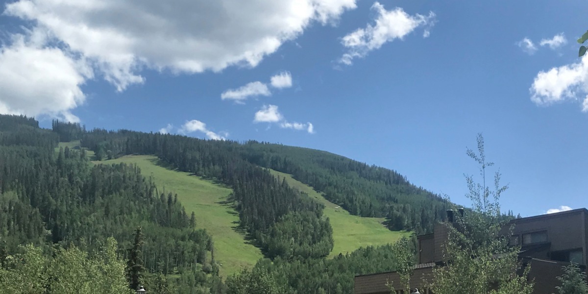
The ski runs become wildflower meadows. Chairlifts give way to hiking trails. Forest roads become scenic walking paths.
One of the best parts? You can choose your own adventure.
Looking for a workout? Hike from the base to the top.
Prefer to save your legs? Ride Gondola One or Eagle Bahn Gondola to the top and enjoy miles of scenic trails without the climb.
Berry Picker Trail
Berry Picker is Vail Mountain's signature hiking trail.
Beginning in Lionshead, the trail climbs nearly 2,000 vertical feet through shaded forest, ski runs, and open meadows before reaching Eagle's Nest.
It's a workout, but one that's rewarded with panoramic mountain views and the option to grab lunch before riding the gondola back down.
Know Before You Go
- Difficulty: Strenuous
- Distance: About 7 miles round trip
- Elevation Gain: Nearly 2,000 vertical feet
- Best Time: July through early September
- Local Tip: Save your knees and ride the Eagle Bahn Gondola back down after earning the climb. It's free to ride down.
- Interactive trail map on CORTEX
Strawberry Lane
If you're looking for a quieter experience, Strawberry Lane is one of the prettiest hikes on the mountain.
The trail winds through dense evergreen forest before emerging into sunny meadows bursting with wildflowers. It's an excellent option for hikers who enjoy a more peaceful setting away from the busiest routes.
Know Before You Go
- Difficulty: Easy to Moderate
- Best For: Wildflowers, quieter hiking, and families looking to explore Vail Mountain.
- Best Time: Mid-summer when the meadows are in bloom.
- Local Tip: This trail pairs perfectly with lunch at Eagle's Nest after riding the gondola.
- Interactive Map on CORTEX
Fireweed Trail
Named for the vibrant pink wildflowers that bloom here in late summer, Fireweed Trail is one of our favorite shorter hikes after riding the gondola.
Gentle grades and incredible scenery make it ideal for families or anyone adjusting to Colorado's elevation.
Know Before You Go
- Difficulty: Easy
- Best For: Families and visitors getting used to Colorado's elevation.
- Best Time: Late July through August when the bright pink fireweed flowers bloom.
- Local Tip: Combine this trail with Eagle's Loop for a relaxing afternoon on the mountain.
- Interactive trail map on CORTEX
Eagle's Loop
For visitors who simply want to stretch their legs and soak in the scenery, Eagle's Loop is hard to beat.
Ride the gondola to the top, wander the loop, enjoy lunch with panoramic views, and spend the afternoon taking in Colorado's high alpine beauty without committing to a strenuous hike.
Know Before You Go
- Difficulty: Easy
- Access: Ride Gondola One or Eagle Bahn Gondola.
- Perfect For: Families, sightseeing, photography, and stretching your legs without a strenuous climb.
- Local Tip: This is one of our favorite recommendations for visitors who want incredible alpine scenery without committing to a long hike.
- Interactive trail map on CORTEX
Mount of the Holy Cross
Know Before You Go
One of Colorado's most iconic fourteeners, Mount of the Holy Cross is about an hour from Vail and makes an unforgettable day or overnight backpacking trip for experienced hikers. Named for the distinctive snow-filled cross etched into its eastern face, this legendary peak is on many Colorado climbers' bucket lists.
- Difficulty: Very Strenuous
- Distance: Approximately 12 miles round trip
- Elevation: 14,005 feet
- Elevation Gain: About 5,600 feet
- Best Time: Mid-July through early September, depending on snow conditions.
- Local Tip: This is not a casual hike. Start well before sunrise, watch the afternoon weather carefully, and only attempt it if you're acclimated to Colorado's elevation and prepared for a long day in the mountains.
- Interactive trail map on CORTRX
What to Pack for Hiking in Vail
A little preparation goes a long way in the Colorado mountains. Weather can change quickly, and at Vail's high elevation, the sun is stronger than many visitors expect. Before you hit the trail, make sure you have a few essentials to stay comfortable from start to finish.
We recommend bringing:
- Sunscreen (even on cloudy days)
- A sun hat for added UV protection
- Sunglasses to protect your eyes
- Plenty of water or a hydration bottle
- Comfortable hiking shoes or trail runners
- A lightweight jacket or fleece for changing mountain weather
- Snacks for longer hikes
- A small daypack to carry your essentials
Shop Hiking Essentials
Browse our favorite sun hats, performance sunglasses, lightweight hiking apparel, sun-protective clothing, and women's hiking shoes before your next Vail adventure.
Whether you're chasing waterfalls, wandering through fields of wildflowers, or standing on the summit of a Colorado fourteener, hiking is one of the best ways to experience Vail in the summer. Every trail offers something a little different, and that's part of what keeps us exploring year after year.
Before you head out, stop by outdoor DIVAS in Lionshead Village. Our team lives, hikes, skis, and adventures right here in the Vail Valley, and we'd love to talk to you about your next adventure in our valley. We'll even point you toward a favorite trail or two.